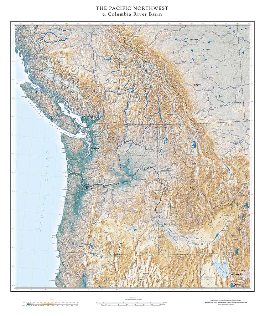
THE PACIFIC NORTHWEST & Columbia River Basin
The Pacific Northwest is conveniently the upper left-hand corner of the United States, an obvious starting point for discussing a series of Regional maps. This is notably a land of great rivers, and the Columbia, greatest in the region (and third in North America, after the Mississippi and the St Lawrence) rises in the Canadian Rockies and collects most of its water there. Our map therefore extends well into Canada. The Snake River, the other main component of the Columbia-Snake system, rises just south of Yellowstone, and includes northern Nevada and Utah in its basin, determining the eastern limits of the map.
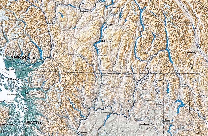
Along with the Columbia, the other great river of the Northwest is the Fraser, which enters salt water just a few miles north of the Canadian border. The Fraser and the Columbia both start out flowing north along the Rocky Mountain Trench, then make concentric dog-leg turns south. This chevron pattern stands out on a continental, let alone a regional,level. The Trench extends all the way from Idaho to Alaska, apparently the expression of some very deep tectonic lineation underlying the active faulting apparent at the surface. The nearly identical great arcs of the two great rivers demonstrate the angle at which two great North American geological provinces intersect.
Detail of the Pacific Northwest Regional Map
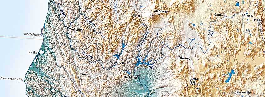
The U.S. portion of the Pacific Northwest is widely identified with the Cascade Range, whose spectacular volcanoes are signature features of western Washington and Oregon and northwestern California. Both Mt. Rainier and Mt. Shasta reach over 14,000 feet; the range extends over 600 miles from Mt. Garibaldi in British Columbia to Mt. Lassen in California. This continuous belt of active volcanoes reflects the extent of the Juan de Fuca tectonic plate, a (relatively) tiny remnant of a once-vast oceanic plate now in the last stages of subduction under the overriding North American plate. The Juan de Fuca plate boundary is at Cape Mendocino, west of Mt Lassen.This marks the “Triple Junction” of the North American, Pacific, and Juan de Fuca plates, and the point where California’s famous San Andreas Fault veers out to sea.
This junction is not a purely academic matter. Cape Mendocino marks the boundary between the land of volcanoes and the land of frequent earthquakes. In the last few decades the danger of the less-frequent subduction zone earthquakes has become clear. These are head-on collisions, not the side-swipes of San Andreas fault earthquakes. Subduction-zone earthquakes are extremely severe. They occur infrequently on a human time-scale, at intervals ranging from a few hundred to perhaps 600 years. The most recent one struck in January of 1800. That was coincidentally just before European settlement began, so the region was assumed to be stable and most of the volcanoes “extinct”. Both those presumptions were mistaken.
Engineering standards in the Pacific Northwest are being revised and insurance companies are pondering the implications.