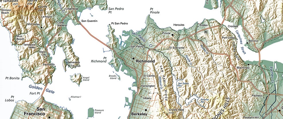
San Francisco Bay is the most notable feature of the Northern California coastline, and the "Bay Area" is known worldwide. That's clear enough, if you don't look too closely.
But how far beyond the Bay does the "Bay Area" extend? Certainly beyond the Carquinez Straits at the end of San Pablo Bay (north of the narrows between Richmond and San Rafael). Bay area settlement has extended all along the south side of the shoreline leading to the Sacramento/San Joaquin River delta. The Delta is its own region, not generally regarded as "Bay Area".
Northern and southern limits are less clear. A conservative definition would extent the Bay Area to the Russian River country - by does that mean to Healdsburg, or further upstream? To the south, Santa Cruz is "Central Coast", not Bay area - but what about the Southern Santa Clara Valley?
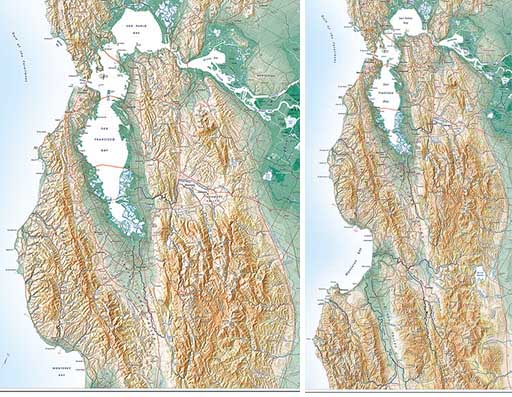
There are no hard and fast answers, so we offer TWO maps. The San Francisco Bay Area map (above,left) is at a slightly larger scale, and is more tightly focused. The Greater Bay Area map (above, right) extends farther north and south south, at a smaller scale.
A little harder to read at a distance, but conveniently narrow if you have a door that could use a map.
