Raven's American West regional map extends north and south of the border, and well out into the Great Plains. This broad overview more than justifies the smaller scale required.
We all know the West as a region of sharp mountain ranges, a marked contrast to the broad stable mid-continent. It is more subtly a land of markedly alternating structural valleys and basins so broad that they easily escape the attention we give to snow-covered peaks.
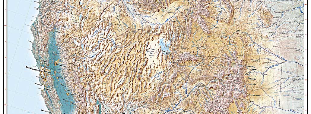
The great valleys of the Pacific Coast (partly submerged under the ocean at their northern and southern extremes) are heavily settled and well-recognized. The sequence of interior basins can't be overlooked. British Columbia's Fraser Plateau, the Columbia, Harney, and Humboldt basins, the Snake River plain, the Great Divide Basin and Salt Lake Valley, the rift valleys of the Central and Southern Rockies, and the lowlands along the Mexican border: all are major features of the American West.
The region can also be viewed from the perspective of its river systems (see above). The Pacific Coast and the Southwest are dominated by the Colorado in the south and the Columbia-Snake in the Northwest (and, in Canada, by the Columbia's northern twin, the Fraser).
The Great Missouri fork of the Mississippi system drains the eastern slope of the Northern and Central Rockies. Headwaters of both Pacific and Mississippi drainages are centered on Yellowstone and the Wind River Range in the north, and the Central Rockies and San Juan Mountains in the south. The river systems are formed by tectonic forces, but then they greatly influence and shape their landscapes.
