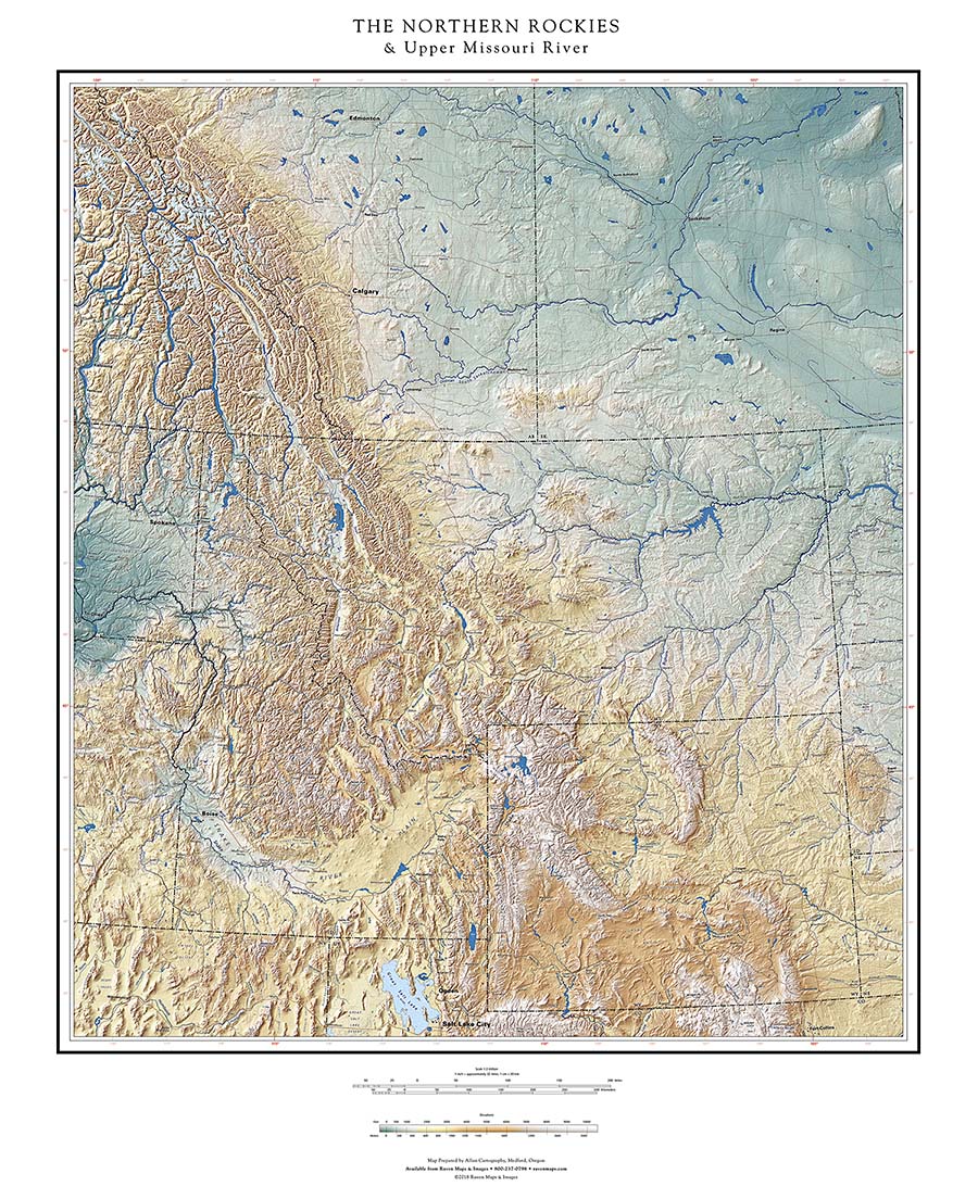
THE NORTHERN ROCKIES & Upper Missouri River
The Rocky Mountains is one of those geographic regional names that makes perfect sense at a continental scale, but gets trickier at larger (more local) scales. The Rockies are composed of many ranges along, and near, the continental divide. How near? That’s where the arguments begin, and they continue. Is it the geology that defines the Rockies, or the geologic period in which the current mountains were raised? Mountains come and go; very (geologically) new mountains can include very old rock. And at what point in Canada do the Rockies merge with the Coast Ranges (which should not be confused with what we call the Coast Ranges in the United States)?
Happily, cartographers can leave those problems to the geologists.
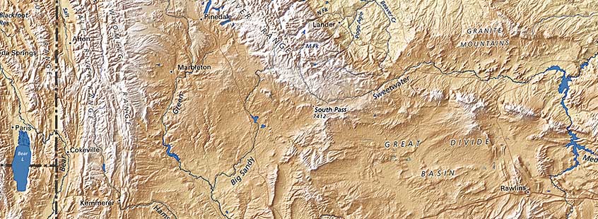
South Pass
We are defining the Northern Rockies in the United States as the ranges north of the high basins of Southern Wyoming. South Pass (see above) at the southeast end of the Wind River Range in northwestern Wyoming is the low elevation route over the continental divide at the south end of the region, found by the fur trade not long after Lewis and Clark demonstrated that the Missouri was NOT a practical route to the Pacific. South Pass was well-known to Native Americans, but transcontinental travel was not their concern. A (relatively) easy route to the Snake River Plain (or, eventually, the Salt Lake Valley) was of great importance to the Europeans. This is a wonderful example of the interaction of physical geography and culture.
Many mountain ranges within “The Northern Rockies” are named, but a great many more locally significant ranges and ridges are not identified. (The cartographic principle is that a names which obscure their subjects make the map less useful, even if more “complete”. Names of mountain ranges, like river names, reflect historic usage: some “ridges” and “creeks” are larger than nearby “ranges” and “rivers”).
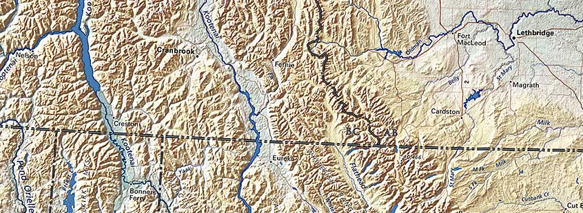
Perhaps the most significant feature on the map that is NOT named is the Rocky Mountain Trench (above), the narrow fault line that extends all the way from Alaska down through Montana's Flathead River Valley. This continuous, nearly straight line is obvious enough without labels, and is occupied by rivers and reservoirs which make legibility a daunting challenge.
The trench hints at the long-term origins of the Rockies, and indeed of the entire western third of the North American continent.
