Raven's new North Atlantic Coast regional map shows New England and Maine as part of the larger region, not as the isolated upper right hand corner of the United States. These states make up a territorial peninsula wedged between the Canadian Maritime Provinces and the (mostly) Canadian St. Lawrence River Valley. It's an unexpected and very informative view.
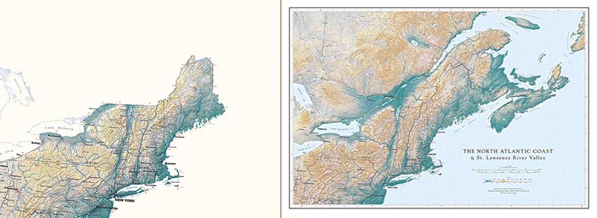
The St. Lawrence Valley marks a fundamental divide in North America. To the south, the Appalachian mountains were raised up by colliding plates, driven by crust moving westward from the spreading mid-Atlantic Ridge. North of the St. Lawrence lies a very different landscape, the stable, more or less immovable continental interior.
The comparatively level "Laurentian Shield" north of the St. Lawrence was covered by recurring ice caps for much for much of the last million and a half years, but its subdued topography is fundamental and very much older. The shield's smooth coastline reflects the long placid history of this physiographic province, very distinct from the intricate coast to the south.
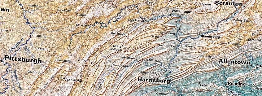
The spectacular folding and long linear seams of the Appalachians are a world apart (see below). The higher northern ridges were considerably carved during the ice age, and impressive glacial moraines (Cape Cod, Long Island) remain on the coast. These are regional surface details, little more than footnotes in the long-term story. The continuous mountain belt extends all the way from northern Alabama through the Gaspé Peninsula and into Newfoundland - presently low and worn, but a significant feature on a global scale.
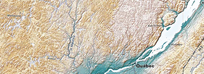
The St. Lawrence-Ottawa route, while direct, was still difficult in the age of canoe travel. Hudson Bay in the far north offered a practical alternative. It involved a much longer sea voyage, but a huge advantage in freighting costs. The Hudson Bay Company outflanked the Montreal trade and eventually took over the northern fur territories, leaving the French along the St. Lawrence stranded between two arms of an expanding British empire. The British prevailed in 1767, but France returned the favor soon afterward, by sending a blockading fleet that compelled the British surrender at Yorktown, just south of our map's southern border.
