Raven maps emphasize landforms, and that means emphasizing rivers as well.
Rivers often follow fault lines, and are always important in shaping landforms, so they are fundamental elements of any map. They also provide the necessary visual organizing reference which, on most maps, are provided by roads and political boundaries. "Ah, these mountains are the ones between the Rapid River and the South Fork of the Smith. I see."
Rivers are frequently dammed, and that poses a couple of cartographic problems. Reservoirs are man-made lades, after all, so shouldn't they be shown in the same way?
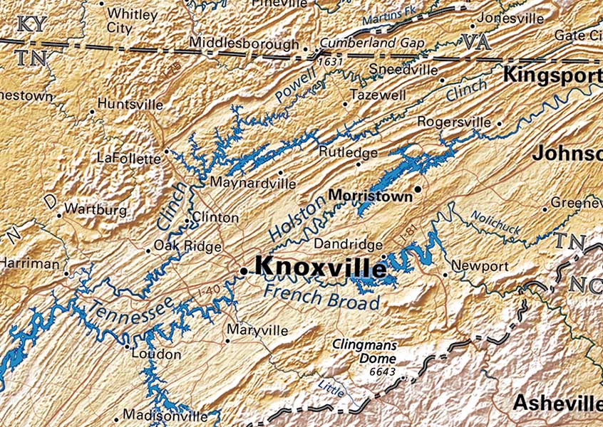
Portion of the Tennessee River Valley on our Appalachians & Ohio River Valley map
Lakes are styled to show up against the underlying elevation tint, (see above) so they vary from dark blue to a light blue or even white (see below). Dark blue lakes work well with rivers, but very light colors interrupt them. In extreme cases, these interruptions make it almost impossible to grasp the river network. In the end, we look for the treatment that makes the drainage pattern clearly visible.
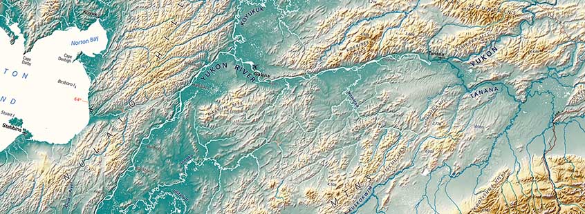
Portion of our fine art print of Alaska
Nearly any map will show important rivers, but what is the standard for "important"? And, when does a "stream" or "creek" graduate to become a "river"?That's a matter of historical circumstance. Many coastal estuaries are named rivers because they appeared important to the navigators or explorers, and the names often stuck, even when it turned out these were simply the tidal mouths of small streams. (See the Mystic River of Massachusetts below)
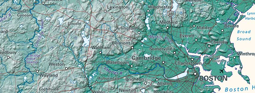
Portion of our fine art print of Massachusetts
There are also regional differences in naming habits - Alaskan "creeks" are commonly very much larger than New England "rivers"- and no great consistency of naming even within states. Raven tries to show the furthest upstream source of the rivers and important creeks we include, but that stream may or may not carry the name of the "main stem".
Portion of our Pacific Northwest Regional map
The image above from the Pacific Northwest map shows that that Clearwater River divides into the Lochsa and the Selway upstream.
This is the norm in much of the world, but is unusual in the United States.
