What are Canada and Mexico doing in geographic regions of the United States?
Restricting map coverage to within defined territorial borders is the default standard. Almost all of the original Raven state map series take that “island map” approach. It’s a great convenience for map production, and also for map buyers: you know exactly what coverage you’re going to get. The downside is that you lose all geographic context, but that’s a reasonable trade-off.
Regional maps are different, since geographic regions are rarely formally defined (administrative regions are another matter). Does the American Southwest really stop at the Mexican border? Well, in some ways, though one could argue. But what about the Great Lakes? You can’t show them very well without including their Canadian shores. The Northeast?
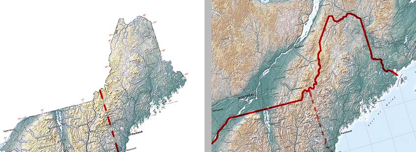
Raven United States map compared to the North Atlantic Coast map
It can be mapped up to the Canadian border, a nice clean stopping point. But that represents Maine as an outlying peninsula, sitting between the open Atlantic and— well, nothing (see above). In fact, the Gulf of Maine is largely sheltered by Nova Scotia, and the state itself is the south-central portion of the northeastern end of the Appalachians. In this case, the geographic context matters a lot.
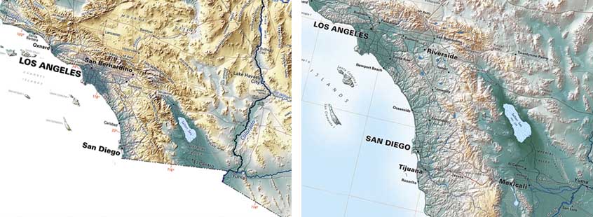
Raven United States map compared to the Southern Rockies map
The Raven Regional Map series takes a broad approach to defining regions. We pay attention to state lines, but also to drainage basins and to the patterns of rivers and coastlines. Our North Atlantic Coast map extends to westernmost Newfoundland, and well up into Quebec and Ontario; both our Southern Plains & Rio Grande Basin and The Southern Rockies & Colorado River Basin (see above) take in the Mexican as well as the American tributaries and the cross-border streams flowing in both directions.
And that's what Canada and Mexico are doing in geographic regions of the United States.
