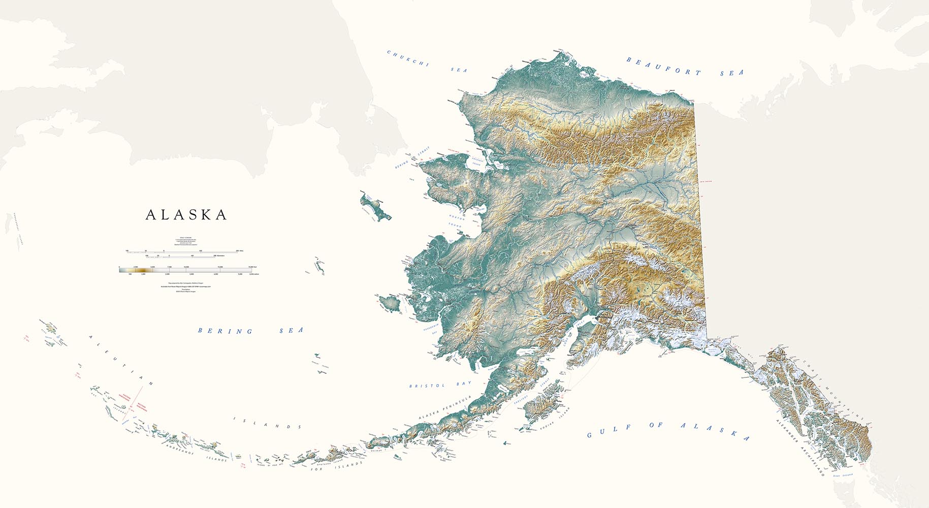
But the state presents some real cartographic design challenges. It is huge, requiring a relatively small scale in order to fit on a sheet that is practical to display.
And it is full of mostly very small settlements and an infinite number of mountains and rivers and bays and capes, tricky enough to label legibly even on a very plain map. Our emphasis on physical features dictates very selective naming. We hope our vivid representation of the landscape makes up for fewer place names.
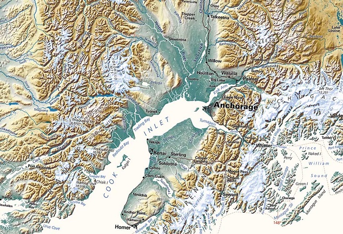
Detail of our largest map of Alaska
In these regions the standard cartographic convention of outlining lake shorelines (as our original Alaska edition did) produces a completely unintelligible tangle of lines. But, our low-elevation dark greens allow us to simply leave the lakes and rivers white. No outline is needed. This approach works well in low-lying areas, but lighter elevation colors require a blue line for visibility. How do we square that circle?
We went back and forth with this problem. In the end we use both treatments. We shift river and lake color from white to blue, based on background color and visual continuity. This is not a hyper-logical GIS treatment, but an intuitive visual call: a map must first of all make visual sense.
We hope you will agree.
