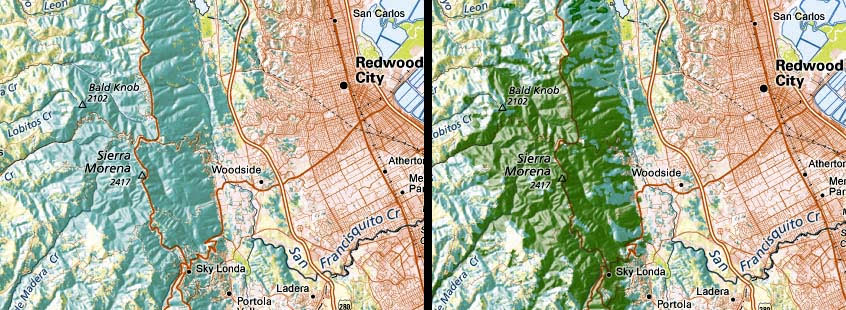
Maps can be colored to show land cover, which indicates built-up areas, cropland, forest land, etc. They can also be colored to show land use, which typically show administrative or zoning characteristics like industrial or residential, parks or agriculture, etc.
High-resolution land cover data is now readily available; the cartographer's task is to select which and how many categories can be shown before the map sinks under the weight of too much information. It is always a judgement call: is "forest" enough, or is there one class of forest land so important for that particular map that it should be shown in a class of its on?
On the California wall map above, we have included the addition of redwood forest near Redwood City.

