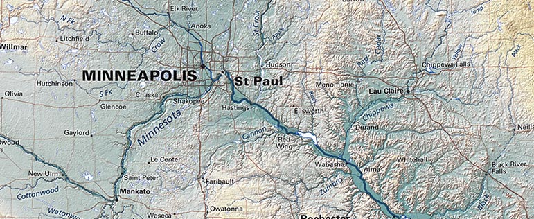
Rivers are a basic feature of nearly all maps. Road maps usually show them as light blue so they will not conflict with the roads that run alongside them, and to avoid a second set of strong line elements that would confuse the eye. Raven lowers roads in the design hierarchy and clearly shows the interesting and often beautiful pattern of rivers (above).
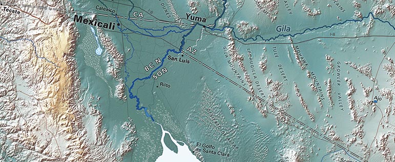
But, emphasizing rivers reveals some confusing paradoxes. Important rivers demand heavier/darker lines than unimportant ones, of course, but what determines importance? The volume of water? In that case, the Colorado River should be shown by a line getting steadily wider as far south as Lake Powell, but then steadily narrower until it vanishes before reaching the Gulf of Mexico. Logical, but it would look nonsensical (below).
Or, importance could be measured by the length of the stream. In that case, the Missouri should be shown by a much wider line than the Mississippi at their confluence at St. Louis, but the Mississippi is by far the larger stream, so THAT would look nonsensical.
Above is a portion of the Northern Rockies Regional Map
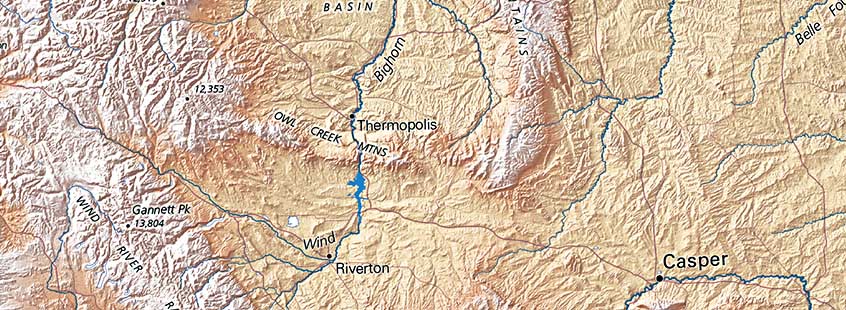
Many cultures give each major portion of a river its own name. The prevailing American practice has been to assign a single name to the main branch, but there’s no fixed rule. Georgia’s long Chattahoochee and Flint Rivers briefly become Florida’s short Apalachicola. In Oregon, the "McKenzie Fork of the Willamette" became the simple “McKenzie", leaving the main stem, misleadingly, the "Middle Fork of the Willamette”. And in Wyoming (above), fur trappers named the Wind River, south of the Owl Creek Mountains, and the Bighorn River north of that range, not knowing that they were the same river.
The names stuck.
.So ... if you are puzzled by a Raven map showing a dry wash as a river, or a named stream rising much further up its basin than some other source does, we probably did that for a reason.
4/11/18
