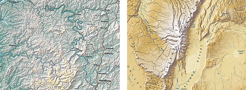
The Elevation tints we use for our wall maps work very well to show one important aspect of landforms: how high one area is in relation to another. Relief shading portrays slope, from flat to gently sloped to steep. Cartographers combine the two, and that gives a pretty good picture of the varied characters of different landforms.
In the examples shown above, the low but steep and stream-eroded mountains of the Coast Range on the map of Oregon (left) are obviously very different from the high-elevation and glacially gouged tilted fault block of the Steens Mountains in eastern Oregon.
3.14.18
